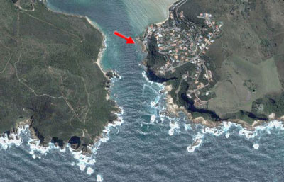
This morning I was using Google maps, and while there, I checked out the updated satellite imagery of South Africa. The resolution is really pretty amazing. Below I posted two screenshots that give you an overhead perspective of one part of our 2004 South Africa trip, in particular, to the coastal town of Knysna. This first pic shows the Heads, the channel between the Indian Ocean and the Knysna lagoon.
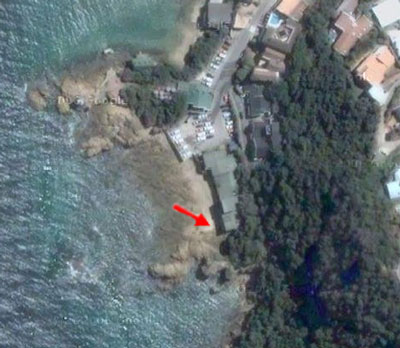
Check this photo for our view from the ground. The red arrow is pointing to Paquita’s, the restaurant where we had a leisurely lunch while watching the waves get suprisingly close. Like several feet. The satellite shot below shows the area at a lower tide…
We simply can’t wait to go back…